Where are we?
How do you begin to know where you are? Before we can begin to tell someone where we are, we have to first have perceived where we are. The process of perceiving where we are has many components; many of these components are constructed in our minds without us even realizing they are happening. We already know for instance that we are on Earth, what country we are in, and likely the state or province as well. Most people do not change their state or province multiple times in a day, but frequent business travelers do so regularly and must still remain oriented to the state and even their time zone. So how is “where” determined? Generally speaking, we all have a point of reference we are comfortable with, thought just as personalities vary, so too does our default for a point of reference category. How we define “where” could be in reference or relation to: the room you are presently in, your home city, your office, latitude and longitude, your house or home street address, and some may even begin with the Milky Way Galaxy. They can all be correct, but are all at a different focus level.
Giving and Receiving Directions
- Is it contemporary to have a concept of time?
- How does time help to know where you are?
 Often, when soliciting information about the location of a restroom, the person providing the directions will simply point, sometimes including some words which generally amount to “Over there.” Obviously, this is a very visual way of relaying information, so the question must be asked, “Where is over there?” There are certainly ways to “frame” the question so that the question is being asked in a way to all but guarantee the information you receive back will be helpful. Based on what you already know about your location, you might say, “Is the restroom toward the front or the back of the store?”, or “Is it to the right or the left?”.
Using the Clock-Face as a Reference
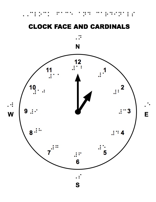
One way of providing directions is using the clock-face as reference. Clock face directions give the ability to be much more precise in aligning with a location or target. This can be used for longer distance or just for pointing the head, shoulders, knees, and toes in the correct direction without having to physically manipulate a person into the direction they need to attend to or point themselves. Being able to aim oneself to the two o’clock position is much easier than making adjustments like, a little more to the right, just a bit to the left, and so on.
Other Systems of Reference for Orientation
Other systems of reference for orientation include using degrees for position and also cardinal or compass directions. All of these systems provide direct ties to the general curriculum and can support a learner’s conceptual development in classes such as math, science, geography, social studies, etc. Working collaboratively with a learner’s entire educational team allows for concepts to be reinforced across the entire day and in multiple settings; it is a “Win, Win, Win” situation for everyone. Developing the regular use of these systems of reference will help the learner go beyond the relative perspective of the self (i.e. to my right or my left), sometimes called an egocentric reference, to an allocentric reference style that uses relationships beyond oneself. They also develop the ability to use the absolute reference of cardinal directions that will remain consistent regardless of the direction they are facing, or even if they are doing a headstand; North is still North!
What is the key here?
- What are the “Key” concepts for maps?
- Would you go so far as to call it a “legend”?
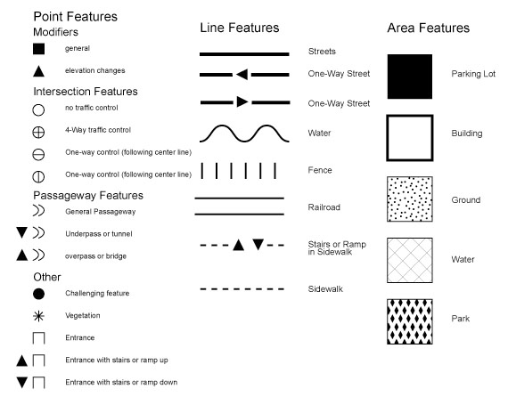
Though students who are blind and visually impaired often begin with braille skills quite early, the skills they will use to relate tactually and spatially to a tactile map are quite different. There are surface patterns that represent terrain such as concrete, grass, bodies of water, etc. to discern, as well as figures for landmarks, boundary lines to track, and various types of pathways to differentiate. As an example of how to represent features on a tactile map, below is an image that contains a symbol set that was developed at the University of Oregon through a National Science Foundation grant.
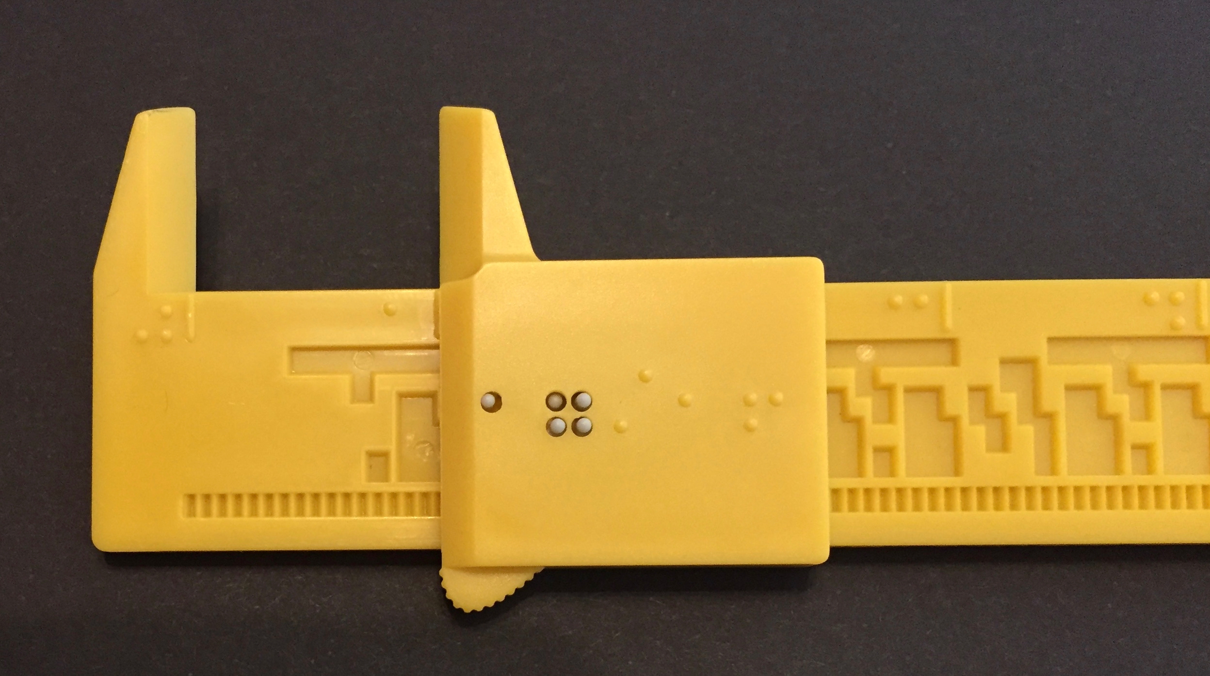
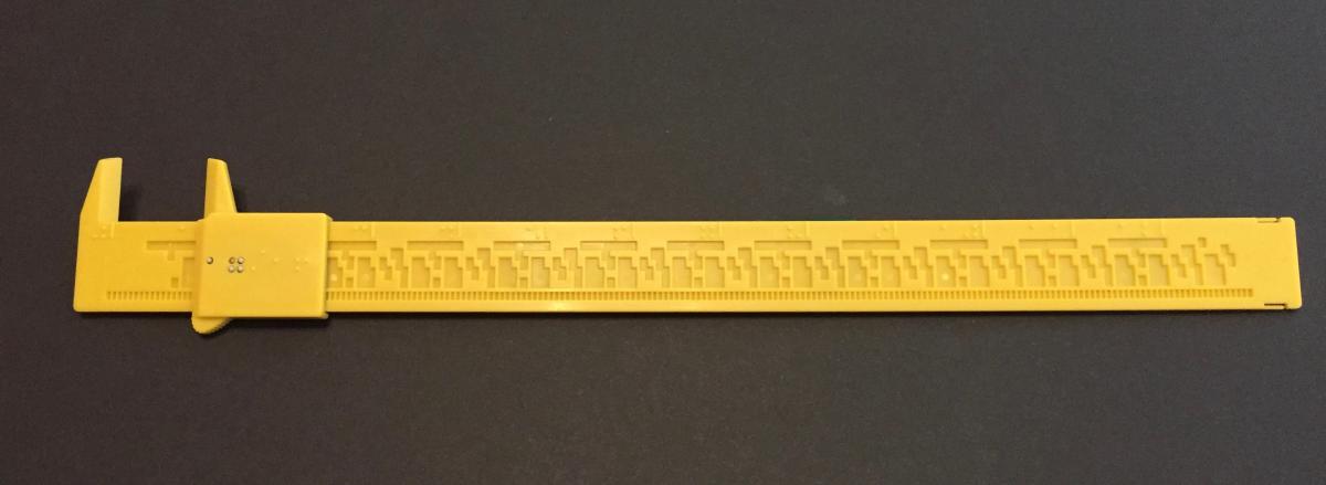
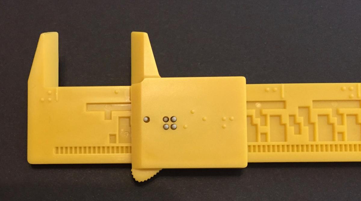
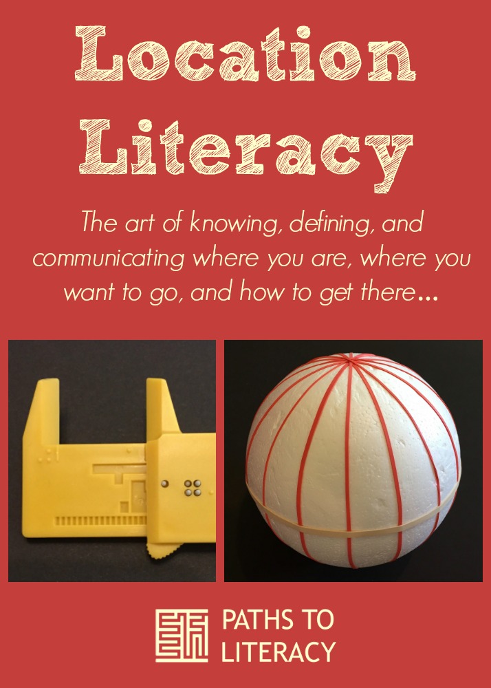
Distance and scale are also areas to teach explicitly. There are activities such as measuring a stride length and using it to pace out the side out the size of a room, football field, etc. But what do you do to transfer that to “map space”? It can be quite challenging to accurately compare distances and sizes on maps if the items being represented are very detailed. For advanced students, it may help to employ measuring tools. One unique and very affordable example that recently became available is the Tactile Caliper; it allows distances and sizes to be measured to 1/16”.
The caliper can be ordered directly from National Braille Press at http://www.nbp.org/ic/nbp/CALIPER.html
Parlez-vous GPS?
-
Is there a language to GPS?
In addition to learning how information is presented from GPS devices and apps, such as how directions and distances are conveyed, there are also details that will likely need some explicit instruction for developing concepts. Latitude and longitude are words that can be bantered around easily enough, but to apply them to knowing and sharing one’s location or the location of a destination a traveler, one needs to have a more fully developed conceptual understanding. Learners who are primarily visual benefit from tools like maps and globes that show lines of latitude and longitude, but how do you make these accessible? There are options like prepared materials from APH, printing using a 3D printer, outlining using a 3D pen, etc., but, there less expensive ways as well. A trip to Michaels Crafts or your favorite hobby store will surely provide a plethora of options. As an example, you can purchase styrofoam balls to represented the sphere of Earth and rubber bands to represent coordinate lines. Pins can be used help locate remember positions on the styrofoam “globes”. (They also come in handy with lines of latitude toward the poles where the rubber bands want to jump right off!!!)
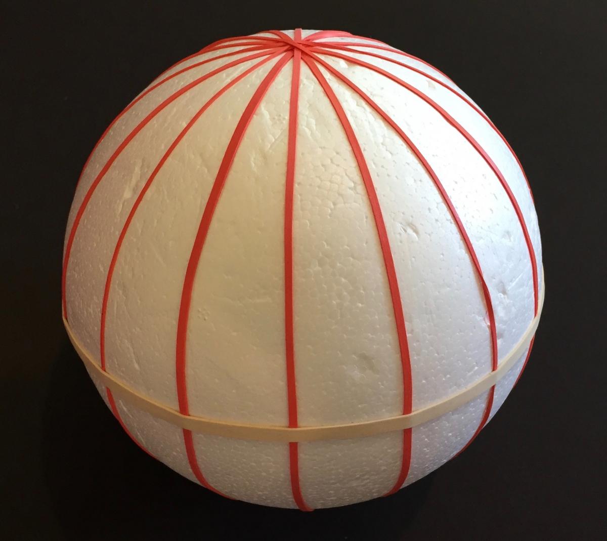
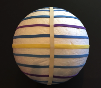
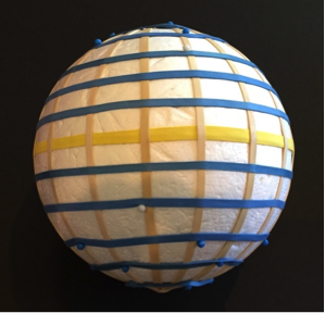
Once the basics of what latitude and longitude represent on Earth are understood, the coordinates used to express location begin to make a lot more sense. Of course there are still more layers of literacy with the expression of coordinates; locations are often expressed in “degrees, minutes, and seconds”, decimal degrees, or even a hybrid of the two formats. There are multiple conversion tools that are free to use on the Web or to download as apps to smartphones.
You are virtually there!
-
Can you explore without actually being there?
There are all sorts of ways to explore areas that are far from your present location for travelers who relate to their world visually, but what about those who travel non-visually? With the power of technology, those locations are just a swipe, click, and tap away. Apps make virtually visiting a location possible from the palm of your hand; there is BlindSquare for iOS smartphones and Nearby Explorer for Android devices (the “online version”, Nearby Explorer Online is a free download from the Google Play Store). There are other options too: for the computer there is Sendero PC Maps with auditory output and keyboard navigation, and if you prefer refreshable braille and auditory combined, options include KeySoft Maps for the BrailleNote from HumanWare and Sense Navigation for the Braille Sense from HIMS.
What resources are there?
Check out all the resources included in the Location Literacy LiveBinder at http://www.livebinders.com/play/play?id=2027667 The binder also includes a separate binder that is all about creating accessible maps, including tactile and auditory maps.
Have fun developing your location literacy!

